Ring Around the World: First Atlas for Children
Hardcover | 68 pages
MRP : ₹ 499/-
₹ 299/- (40% off) inclusive of all taxes
You Save ₹ 200/-
Last 3 In Stock
Delivery : 4 to 7 Days
North East States: 7 to 15 days
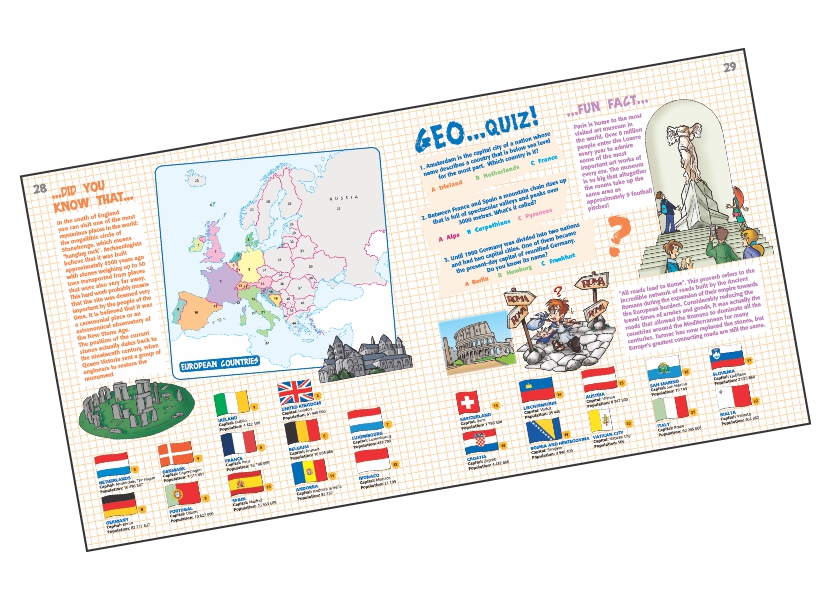
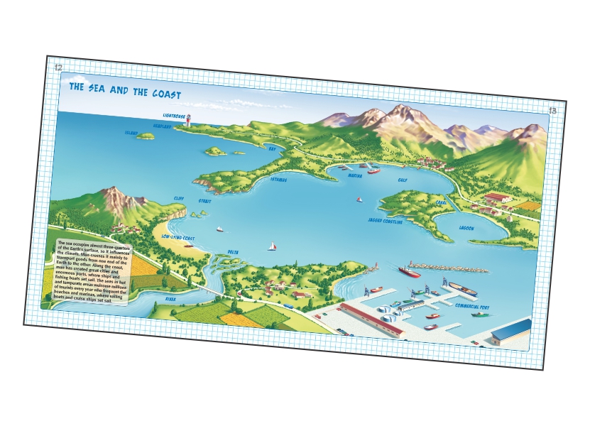
Description : ...DID YOU KNOW THAT... One of the world's biggest deserts lies between Mongolia and China: the Gobi, which literally means "desert" in Mongolian? This children's atlas contains lots of fun facts for kids, physical and country maps, geo quizzes and information about the world they live in. PHYSICAL MAPS Physical & environmental maps: Discover each continent from its territories, rivers and lakes to its mountains and deserts. FUN FACT St. Basil's Cathedral marks the geometric centre of Moscow, the capital of Russia. Its multi-coloured façade and spires aim to represent the flame... MAPS OF COUNTRIES Country and population maps: Learn about different continents and their inhabitants ENVIRONMENTS In these large illustrated pages you will learn about the environment in which you live. GEO...QUIZ! Geographically the Hawaiian Islands are part of Oceania, but politically they are? ABC.
Product Details
Publisher : Wilco Publishing House
Publication Year : 2015
Language : English
ISBN : 9788182525993
Categories : CHILDREN: REFERENCE & KNOWLEDGE
Product Dimension : 1.4 X 27.6 X 28.6 cm
Weight : 0.68 kgs
DELIVERY DETAILS
FREE DELIVERY
On all titles in 'Bargains -New Arrivals'
On all titles in 'Bestsellers -Prebooking'
On all titles in 'Classics Deal'
On all titles wherever specified
On order value > ₹ 999/-
For Orders < 999/-
Shipping charges as follows
₹ 1 - ₹ 500 : ₹ 50
₹ 501 - ₹ 999 : ₹ 100
(above charges apply for shipping within India only)
Pin Code Checker